Elevation: 4022m to 4723m
Total Ascent: 856m
Distance: 14.79km
Hiking duration: 7h 14min

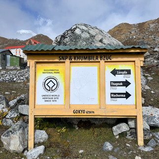
This day was a particularly critical day on our journey. Due to our flights being cancelled and taking the jeep instead, our total journey would take 1 more day than planned. Although we had 2 buffer days in case something like this happened, we still did not want to use them in case there were more unexpected events ahead. Typically, the journey from Dole to Gokyo would be split into 2 days, stopping at Machermo. This was to reduce the chances of altitude sickness. However, given our trekking pace and exertion, we decided to head straight to Gokyo.
Given my past brushes with altitude sickness (at 3000+m and 4000+m), I knew that my body was extremely prone to it. Hence, it was not a decision that we took lightly and even though we hiked slowly, we monitored the conditions of our group closely as we hiked up.


From Dole, we took roughly just 2.5 hours to hike to Machermo. The path was mostly flat, gradually ascending. Seeing that we had hiked pretty fast, we took a 1hr lunch break here to recuperate for the tough journey ahead.
Here we learned the truth that the "fuel" used to warm our stoves nightly was actually dried yak poop that they collect daily! We see them all the time drying in the sun outside the houses.

Also, they used solar energy to boil water!

The lunch spot at Machermo has a bomber garlic soup, rich and creamy garlic that warmed our stomachs. Our guide told us that garlic soup was often used as a remedy for altitude sickness and the cold.

After lunch, we continued on our journey to Gokyo. The trail was relatively flat for about an hour after lunch. Then it suddenly became very steep as we hiked up the way to the Gokyo lakes.
The hike up was quite intense and cold. Around this point, Ann Ying and myself had felt a bit of a headache and informed us. Most likely, this was from a combination of the cold, altitude and also exertion. As the headaches were quite mild, we decided to continue on slowly with longer rest in between and also monitor the situation. We also hydrated more to reduce the chances of altitude sickness. Slowly but surely, we reached the top of the hill.

The sight of the first Lake gave us a sense of relief as it was beautiful and meant that the incline was almost over.

exhausted from the climb and the thin air, we walked slow even though the ground was mostly flat by this point. about 20 minutes more of hiking and we caught the first glimpse of our stay for the night, Gokyo.

We made it at last! We were all exhausted from the long hike and also because of the altitude gain of 700m that day. After settling down for some time, I started to develop mild symptoms of altitude sickness, headache and nauseous feeling. I barely had an apetite for dinner. I tried to munch down on the chow mian that I got for dinner, but still left most of the plate uneaten. We got to sleep soon afterwards. Luckily, the symptoms didnt persist overnight.

Overall, this was a slightly challenging day, not so much due to the inclined climb, but because of the elevation gain and our inexperience with it. If given the chance to go again, I would definitely have hiked slower, and hydrated more. Maybe even take a night to rest at Machermo before heading further up. But it's still up to the individual's fitness, experience and body to decide how best to tackle such cases.


Comentarii